
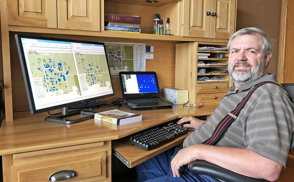
BROOKINGS – After he retired, Doug Oleson got to thinking about his time on the campus of South Dakota State University and one building in particular.
That inspired him to create a map that showed the evolution of the SDSU campus from inception in 1881 to 2019.
That map is now featured on the sdstate.edu website, at https://www.sdstate.edu/campus-evolution-map online.
Inspiration
Five years ago, Doug Oleson retired from his job as a software engineer at Boeing in Seattle, where he worked for 32 years, and moved to Brookings with his wife Sandra. A native of Arlington, Oleson had earned a bachelor’s degree in math and a minor in computer science at South Dakota State University in 1981.
A couple of years ago, Oleson got to thinking about his days on the SDSU campus.
“There used to be a building on campus called the Hippodrome. And I remember taking a P.E. class and being in the Hippodrome. It wasn’t much of a building. It was only there for a few years, but I couldn’t remember where it was,” Oleson said.
He couldn’t leave it alone, so he visited Briggs Library and looked at old maps and old course catalogues and located the Hippodrome.
“And it happened to be right where the statues of Weary Wil and Dirty Lil are now, north of the Union,” Oleson said.
He figured others might want to stroll down memory lane and probably had questions about buildings and other things on campus.
“I figured, I wish there was just one place that you could go and answer your own question where was that, when was that there, what’s there now. So that was the seed,” Oleson said.
Cure for boredom
So he decided to put his software engineer experience to work.
“And I was bored,” Oleson said.
He wanted to put together an interactive map.
“I thought, how else would you have all the information in one place?” he added.
He started researching on the internet.
“Part of my job was to do databases, and I’ve always been interested in geography. But I had never done any internet work, no HTML, nothing like that and I had to learn that, but it wasn’t hard,” Oleson said.
SDSU’s Marketing & Communications creates the official maps of the campus.
“I told them what I had in mind, and they offered me their original artwork which was in Adobe Illustrator with the proviso that I not profit from it. I had no problem with that,” Oleson said.
With those maps and some he scanned from course catalogues and other sources, he overlaid them with each other and started playing around with possibilities.
“My other major source was the Digital Library of South Dakota archives. There’s a set of overhead imagery – pictures taken from airplanes. The oldest of those is 1921,” he said.
The project evolved, he said.
“With any software, it hit a lot of dead ends,” Oleson said.
He purchased Adobe Illustrator and other Adobe products to do what he needed to do and said the hardest part was learning HTML. He got help from Johnson Design, in particular Erik Ebsen.
“I fiddled with that for about six months before anything started to look like what I wanted it to look like,” Oleson said.
Part of the challenge was not all the maps were in the same format, making it hard to overlay them. The overhead images weren’t all labeled with the correct year.
“Bad data is worse than no data,” he said, stressing the importance of keeping accurate records.
“So basically I just used that as reference material: what was there in 1971, and what had disappeared in each year,” Oleson said.
“I started showing it to friends after about a year,” he said.
More than a concept
“Cool” was the reaction he got most often.
“I got positive reactions – I don’t think anybody gave me a negative reaction, but I picked who I showed it to, based on what I thought their interests would be,” Oleson said.
One of the people he showed it to was his brother, Roger, a “map guy” who was a geography major and works for Eros Data Center near Baltic.
“He showed it around at Eros …. Whenever he did, productivity plummeted,” Oleson said with a twinkle. “You can spend more time than you think on it.”
He admits he started the project for himself, but it evolved into a curiosity for others, as well.
“I invite questions,” Oleson said, adding he’s talked to people, who like him, had questions about where a building was on campus or when a street went in. He said he’s “anal about data integrity and data accuracy is very important,” so he shows reference work to back up his project’s accuracy.
What is it for?
He was asked a lot what he was going to do with the map and what it could be used for.
“When it finally got into a final form, I put it on my personal website so that people around could find it and pass it along and then I got the university to agree to host the map,” Oleson said, adding the Alumni Association was “really excited” about it.
To find the map, go to sdstate.edu, click on Menu (at the top right), Tools & Quick Links, Maps & Directions and scroll to the bottom and click on the map.
The map can be used to illustrate historical points.
“Found out recently that a history professor was talking about post-World War II, how building slowed down during the war and boomed afterwards,” Oleson said, noting the veterans coming back from the war wanted to go to school on the G.I. Bill.
“It was like 1946 that the university brought in a bunch of barracks that were used for married student housing and you can see on the map that they added quite a bit of stuff after the war,” he added.
“These barracks, I guess they came from Pickstown. When they finished the Fort Randall Dam, (they) were gonna condemn the barracks, but they moved them here instead. Like I said, married student housing, it was nicknamed Fertility Row … start of the Baby Boom,” Oleson said.
The future
He’s already thinking about version 2 of the map, although “that’s not any time in the near future,” Oleson said.
He plans to update the map every year to keep it current and is getting some help from Rachel Fritz with Marketing & Communications, who does the official map.
Although it was a lot of work, he’s glad he did it.
“Kept me busy for a couple of years. You need something to do in the winter,” Oleson said.
Contact Jodelle Greiner at jgreiner@brookingsregister.com.


